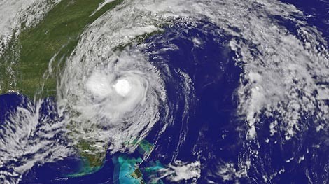
Image by NASAImage by 20080905hanna2.jpg Hanna's movement up to 3:15 p.m. -- Can't see South Carolina? that's because we're enveloped by Hanna.
Update 4 p.m.: We're coming up on the main stretch of Hanna, and the latest update put the storm as having sustained winds of 70 mph, just beneath the hurricane requirement of 74 mph winds -- though the difference is little more than a technicality.
Wind speeds are expected to continue to increase through tonight from their current 25 mph up to 40, 50 or even higher mph speeds. Some gusts will possibly even go as high as 70 mph.
As those winds increase, it becomes more likely that bridges could close this evening. Also, several downtown streets are flooded, so stay off the roads as much as you can.
Conditions will generally peak around midnight to 3 a.m. and start to improve as the core of Hannah starts to pass, likely making land fall between Charleston and North Carolina.
If you're concerned about your safety, several shelters are open.
Also, The Post and Courier has a good roundup.
Watch our for the worst flooding tonight, not only will the storm be cresting but the tide will be high, impeding the city's low-lying drains.
Update 9 a.m.: The storm's expected path has shifted to the west, putting landfall near Myrtle Beach. Other changes are reflected below.
Original post: Today is the day: Rain and winds are expected to start their approach around 8 a.m., with a total of around 3 4 inches of rain possible throughout the storm and winds topping out around 8 11 p.m. at nearly 50 55 mph.
We should feel our worst of Hanna late tonight.
It looks like we're dodging the brunt of the storm as poorly organized Tropical Storm Hanna is expected to hit near Wilmington, North Carolina.
Here's some things you should do:
- Stay tuned to the National Hurricane Center for any changes in the storm.
Tropical storm-force winds are reaching about 300 miles out from the center of Hanna, so it's no monster but it can still be dangerous. Waves are expected to crest out around 9 10 feet later in the day.
Also, keep an eye on Hurricane Ike which will likely drift onto our radar around Monday or Tuesday.


