Image by National Weather ServiceImage by 20090815-ana.jpg
Update: Check out our updated story.
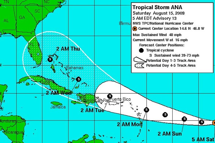
It's finally happened: The Atlantic has received its first named storm of 2009.
Read more stories on this subject in our hurricane special section.And the current guesstimate pegs the storm as curving across the Bahamas and towards central Florida, a route that should be watched for possible curvature towards South Carolina.
The good news is that if the storm heads like its expected to it will cross over many island areas, which will make it hard for the storm to get past tropical storm strength. And on the upside (for us) the various computer models have it leaning more towards Cuba than the open Atlantic.
And don't forget to keep your eyes open as the season's really gotten under way and it looks like there could be another storm backing up Ana.
As always, we'll keep you posted. But for more in depth analysis don't forget to check out Dr. Jeff Masters' WunderBlog.
Update 11 a.m.: The latest forecast from the National Weather Service pegs the storm on slightly more southernly track.
Update August 15, 5 p.m.: Folks close to the Gulf Coast better watch out as this one is shifting that way. Here's the latest forecast.
But Charleston's definietly not out the woods yet, especially as Tropical Storm Bill has just formed and is curving a bit more north.


