Image by Charleston CountyImage by 20080818pictometry.jpg The new software showing the Charleston County Public Services Building on Leeds Avenue.
Charleston County is using a new system that lets 911 dispatchers ditch the maps of 90s and get birds-eye photos of the caller's scene.
 County's Pictometry software on left, Microsoft LiveMaps view on right.At first glance the system doesn't seem all that different from Microsoft's LiveSearch Maps but the county touts that:
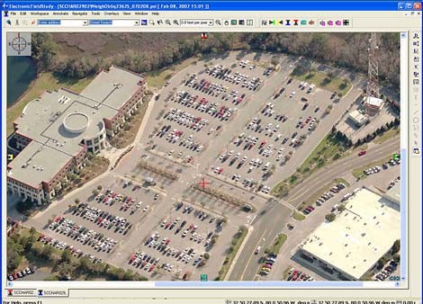
Pictometry also provides dispatchers with tools that allow them to measure distance, area and height of structures within the image. Dispatchers are now able to provide the distance of a road not easily seen by the responders on the ground or at night. They can determine the height of a building for fire fighting purposes or the original square footage of a structure damaged by a natural event.
The new tools allow the dispatchers to be able to keep a record of ongoing, long-term events, such as a hazardous materials spill.
Get loads more info in the full press release.
Update 7:02 p.m.: Live 5 News has video on the new system and a write-up. Watch it here: